
Rating: 3.0 out of 5 stars
Recommended supplies and information:
- Bring at least 80 ounces (about 2 liter) of water
- Water Purification System (water sources are available)
- Electrolyte Energy Tablets
- Trekking Pole
- Small First Aid Kit
- GPS
Approximate Trekking information:
Total Distance Hiking Round Trip: 6.3 Miles (10.1 km)
Elevation 8,291 ft to 8,983 ft: 692 ft Ascension Climb
Elevation Metrics: 2,527 meters to 2,738 meters: 211 meters Ascension Climb
Temperature for January 6, 2017: 49.6 F to 74.5 F / 9.7 C to 23.6 C

Fir Trail, Squirrel Springs,Greer, Arizona
A Winter Wonderland
Not very often do I have an opportunity to trek in snowy environments. However, being up in Pinetop, Arizona in January, I couldn’t resist the chance to travel over to Greer, AZ and check out the Squirrel Springs wilderness area. Since Pinetop and Greer are within a region of unpredictable weather conditions, Pinetop had scattered patches of melting snow, while Greer was completely covered within a winter wonderland.
Pulling my truck into the Squirrel Springs trailhead, I was not surprised to see an empty parking lot. The entire area was blanketed with a layer of freshly fallen snow. Conveniently, there was an impeccably clean public restroom facility adjacent to the trailhead.

Melting Snow Water Source, Squirrel Springs,Greer, Arizona
Snowy Trail
After signing the trail hiking logbook, I began my trek onto Fir Trail. Within a few hundred feet, I passed through an opened gated property fence. An extremely beautiful scenery of snow and ponderosa pines accented the deep blue sky. I couldn’t have asked for better hiking conditions on this Friday morning.
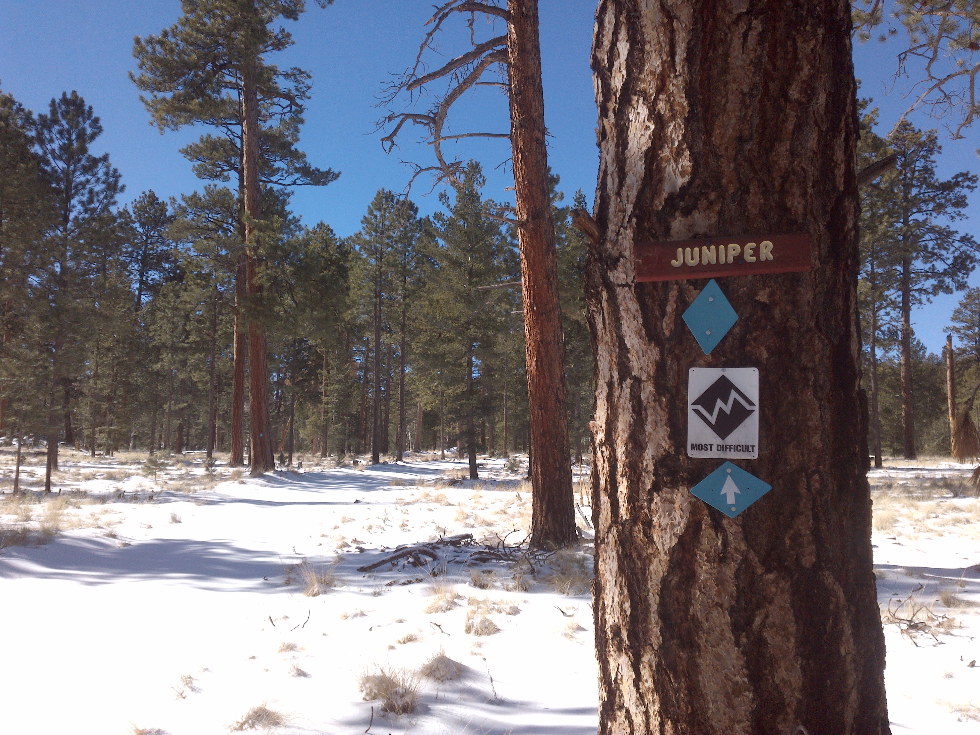
Juniper Trail, Squirrel Springs,Greer, Arizona
The trail was wide and appeared to be an old logging road with excellent blaze markings on the trees. The trail was completely covered with snow, so getting lost is difficult since the trail is well marked. On the entire hike, I did not see a single person or footprint other than an occasional elk or deer imprint. Therefore, the trek was very peaceful and the only other sound I heard was that of my own boots trudging through the dry snow.
Mountain View, Squirrel Springs,Greer, Arizona
The trail meanders in a south west direction parallel between Rosey Creek and Benny Creek. So, there is a plentiful water supply for those wishing to veer off-trail a short distance to resupply.
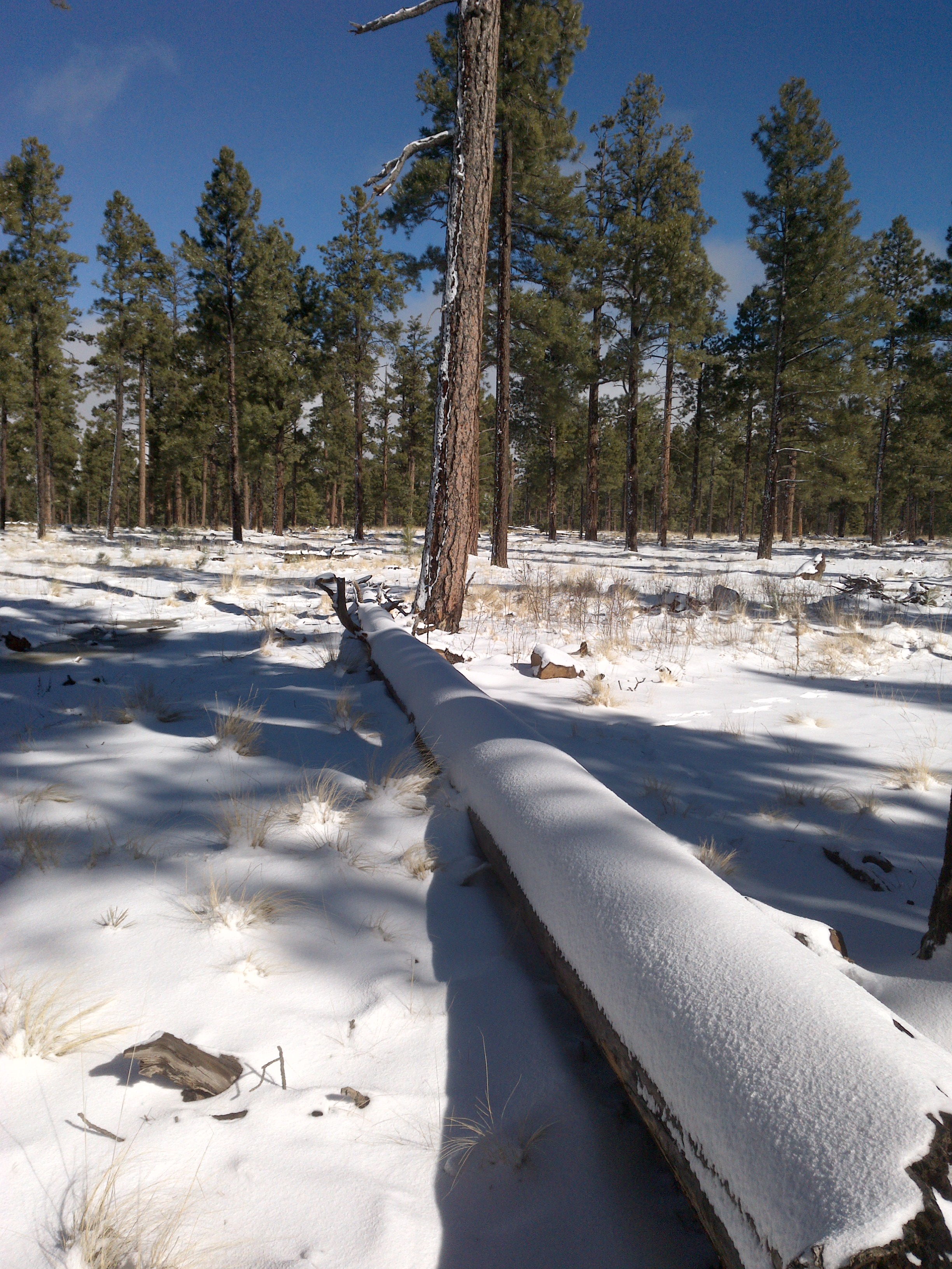
Snow Covered Fallen Tree, Squirrel Springs,Greer, Arizona
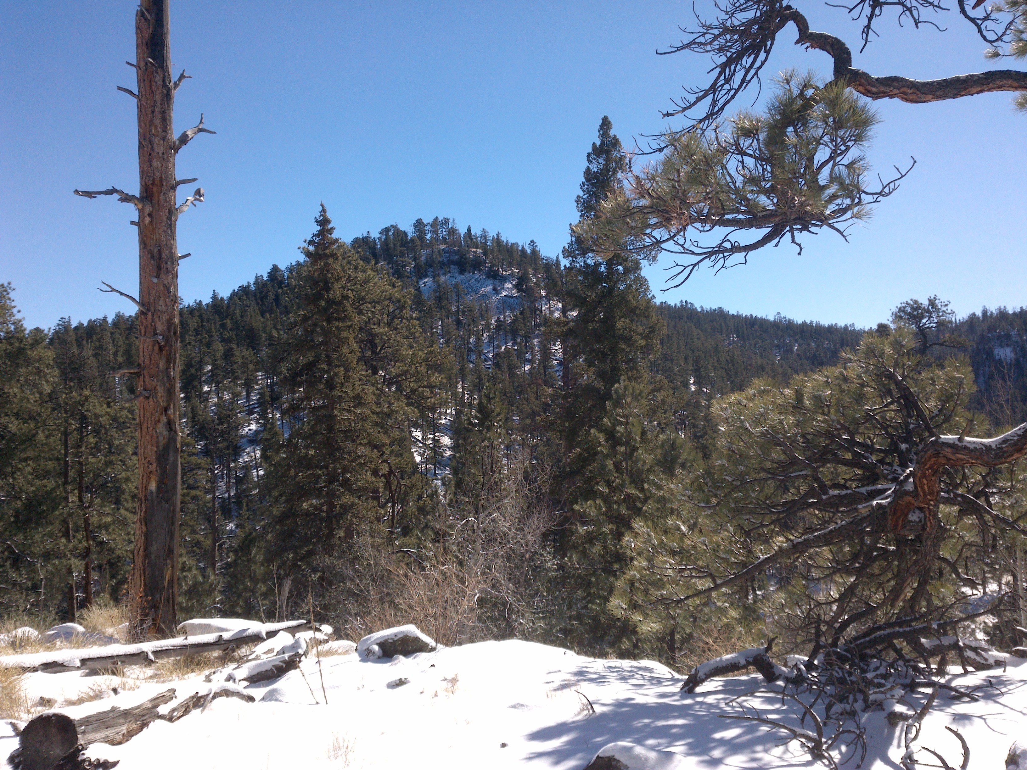
Glimpses of Nearby Mountains
As I slowly ascending up the trail a few hundred feet in elevation, I noticed a clearing in the pine trees to the south (leftside). To my surprise, a wonderful view of a gorgeous mountain and forested valley was before me. The view was not by any means a jaw dropping awe inspiring view, but it certainly stood on its own for an individual beauty showcasing the surrounding mountain terrain. Unfortunately, hiking this particular trail, multiple expansive picturesque mountain and lake views were lacking. However, the solitude and pristine nature of the region made up for it.

Deepening Snow, Squirrel Springs,Greer, Arizona
Deepening Snow
As I continued to slog through the paths, I began to notice the higher in elevation I went, the deeper the snow had accumulated. My trekking adventure commenced with about an inch or so at the beginning of the trailhead down by the parking lot. As I ascending to about 8,800 feet (2438.4 meters), it measured about 6 inches (15.24 centimeters) in depth making it much more difficult to negotiate the trails. At this point, snowshoes would have been the way to go.

Birch Trees, Squirrel Springs,Greer, Arizona
After about three miles of hiking through the deepening snow, I decided to cut the trail loop short by about .25 miles. I could actually see the trail loop around with a surrounding meadow in the foreground. Going off-trail just west of the path would be an ascending climb to another view of which I am assuming would be the White Mountain Reservoir and Sunrise Ski Resort in the distance. Unfortunately, the snow was getting too deep to hike in boots, so I will have to attempt this hike again in the summer months.

Final Loop Meadow, Squirrel Springs,Greer, Arizona
Final Thoughts
Squirrel Springs is a great location for a fun hike to get out into the wilderness, breathe some fresh air, and enjoy the peacefulness of nature. In dry summer months, I would highly recommend trail running and mountain biking at this location. Since the trails are wide and not difficult to walk, all ages and athletic levels would be welcomed.
Although I rated this trek a 3 out of a possible 5 stars, on account of a lack of spectacular views, I will certainly return to this location to do some more exploring and possibly mountain biking. There are approximately 14 trails in this region that run parallel to Hall, Rosey, and Benny Creek. So, a lack of water will never be an issue. I thoroughly enjoyed hiking Squirrel Springs and am looking forward to my next adventure in the Greer, Arizona area.
View all images of the trail:
http://www.davidpinter.com/arizonatrekker/treks/squirrelsprings/
View Complete Trekking Analysis One Way
http://www.movescount.com/moves/move137674978
View GPS Map and photo locations:
http://www.davidpinter.com/arizonatrekker/treks/squirrelspringsgps/

Directions:
Traveling from Payson, AZ head east on Route 260. Keep heading east on 260 past Pinetop for about 50 minutes and take a right turn onto Route 373. About 2 miles on the right you will see a sign for Squirrel Springs campground.
