
Rating: 4.8 out of 5 stars
Recommended supplies and information:
- Bring at least 80 ounces (about 2 liter) of water
- Water Purification System (water sources are available)
- Electrolyte Energy Tablets
- Small First Aid Kit
- GPS
- Camera
Approximate Trekking information:
Total Distance with Bike and Additional Hiking: 15.9 Miles (25.6 km)
Bear Canyon Trail Distance Round Trip: .25 miles (.4 km)
Total Hiking and Biking Time: 3.11 hours
Elevation at base 7,631 ft to 7,956 ft: 325 ft Ascension Climb
Elevation at base Metrics: 2,325 meters to 2,424 meters: 99 meters Ascension Climb
Temperature for June 21, 2016: 77.4 F to 95.2 F / 25.2 C to 35.1 C

- David Pinter at Carr Lake Trailhead, Mogollon Rim, Payson, Arizona
A Breath of Fresh Air
For quite some time, I had been researching topographic maps surrounding the Payson, Mogollon Rim region of Arizona. I was interested in creating a multi terrain adventure that would lead me across the inner expanse of the high desert. But, the main driving force was to search and find the illusive Bear Canyon Lake.
Bear Canyon Lake is tucked far away from the more popular tourist camping destinations. Most campers tend to frequent Willow Springs Lake and Woods Canyon Lake campgrounds just off Route 260 just outside of Payson and Star Valley in Coconino County. Nearby are Aspen and Rocky Point Recreation Areas. But interestingly, no one has ever heard of Bear Canyon Lake or knows where it is located in the labyrinth of ancient logging and forest roads atop the Mogollon Rim.

- Carr Lake Trailhead Sign Postings, Mogollon Rim, Payson, Arizona
I knew this would be the perfect time to brush up on my GPS navigational skills, and to search and find this hidden and mysterious lake. I decided to mountain bike a majority of the trails since the Arizona June temperatures were beginning to spike over the week. Leaving early in the morning and arriving at a designated trailhead was part of my plan to stay cool and keep my body core temperature down. The weather was perfect with portions of the sky filled with sun blocking clouds.

- General Crook Trail On Route to Bear Canyon Lake, Mogollon Rim, Payson, Arizona
Carr Lake Trailhead: General Crook Trail 140
I would highly recommend to anyone Mountain biking and hiking on a Tuesday. It’s a great way to minimize crowded trails and tourist noise. The trailhead itself was completely empty of hikers with ample parking abound. The surrounding area was well treed with plenty of shade. The starting trail is actually General Crook Trail that primarily maneuvers in a northwest direction. Biking down the narrow trail was a little cumbersome in some portions on account of sand, softball sized rocks and large pinecones.

- Pine Needle Covering on General Crook Trail On Route to Bear Canyon Lake, Mogollon Rim, Payson, Arizona
Gorgeous Forest Views with Open Green Meadows
Meandering through the shaded forest was an absolute delight. Scents of the pine trees and picturesque views of aspens delightfully enhanced my outdoor experience. I’ve been trekking and biking all over Arizona, but this place I could tell was going to be something very special. There is nothing better to me when a trail is rarely traveled upon.

- Trail Split: Aspen and General Crook Trail, Mogollon Rim, Payson, Arizona
Now and then, General Crook Trail intersects with other trails and logging roads. Aspen Trail was one such trail that I decided to navigate along since it brought me closer to the Mogollon Rim views.

- General Crook Trail On Route to Bear Canyon Lake, Mogollon Rim, Payson, Arizona
There were beautiful points along the trail to take in the true expanses of nature. The views were spectacular.

- Shaded Forest Trail, Mogollon Rim, Payson, Arizona
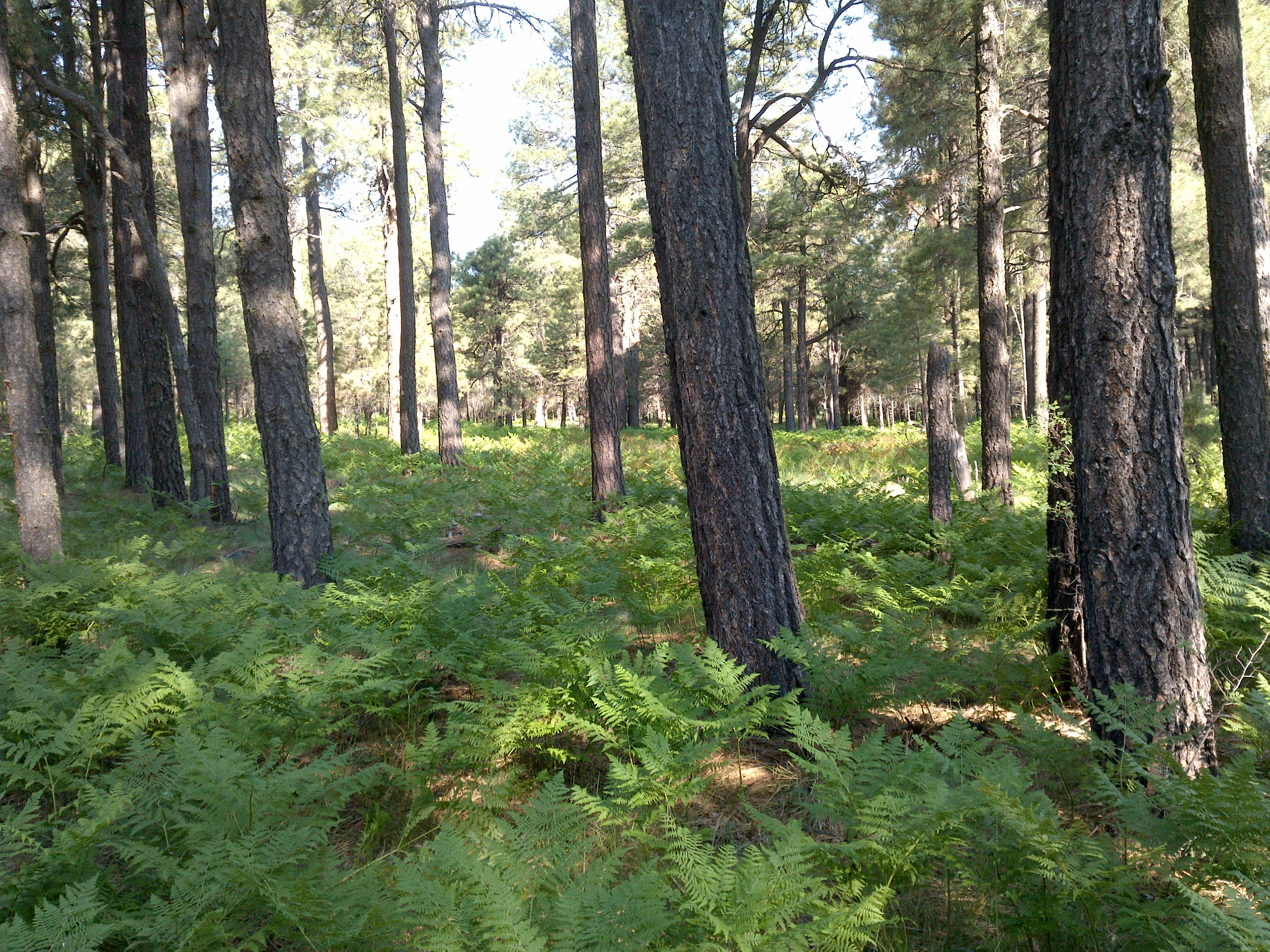
- Fern Ground Covering, Mogollon Rim, Payson, Arizona

- Meadow View, Mogollon Rim, Payson, Arizona

- Aspen Trail On Route to Bear Canyon Lake, Mogollon Rim, Payson, Arizona
Logging Roads
Portions of the unfrequented Aspen Trail were becoming too difficult to mountain bike. So I decided to GPS switchback onto an old pine needle covered logging road. Traveling closer and closer to Bear Canyon Lake, I finally came to an intersection that crossed Rim Road Route 300. I continued north down a decently maintained dirt road.

- Logging Road Mountain Bike Jump On Route to Bear Canyon Lake, Mogollon Rim, Payson, Arizona
After riding about two miles, the road ended into what appeared to be a remote camping area. I saw one car, a pup tent, and two people standing and drinking from a metal thermos bottle. Riding to the end of this concealed road, I was initially disappointed by not seeing the lake.

- Bear Canyon Lake Trail, Mogollon Rim, Payson, Arizona
Bear Canyon Lake Trail
After inspecting the small campground more attentively, I noticed an obscure trail steeply heading down into the forest. I attempted to ride the trail, but it was too extreme and way beyond my skill level. Plus, eventually I knew I would have to push the mountain bike back up and out of the very rocky trail. So, I decided to hide my bike off-trail a hundred feet or so into the woods and hike down to the unseen lake.

- Rocky and Steep Bear Canyon Lake Trail, Mogollon Rim, Payson, Arizona
After trekking down the trail with several twists and turns, there was no sign of the lake in sight. I was determined, so I continued to trek further and further down the trail in elevation. Then out of nowhere, the trail finally opened up to reveal a soft and green grassy meadow with a beautiful lake swaddled within the forested canyon walls.

- South Bear Canyon Lake, Mogollon Rim, Payson, Arizona
My first impression was a feeling of pure awe. My second impression was in amazement while gazing at the pristine surroundings. There was no one other than me to enjoy Bear Canyon Lake at its most southern tip location. There were no boats or people, only the wind, a hawk soaring above me, the sounds of the rippling water splashing up against the embankment, and a friendly and cute chipmunk wanting some Cheezits I had packed in for lunch.

- A Small Portion of Bear Canyon Lake, Mogollon Rim, Payson, Arizona
Fresh Clean Water
Although the lake water is very clean , I still take precautions in drinking any water source I come upon. I used my Camelbak UV All Clear water bottle to clean the water before drinking. I usually add a Nuun electrolyte grape flavored tablet to my drinking water to give me a little extra energy for the long trip back.

- Camelbak All Clear Water UV Purifying Bottle at Bear Canyon Lake, Mogollon Rim, Payson, Arizona
After guzzling down a whole bottle of lake water, I purified another bottle of water and added it to my empty rubber bladder in my pack. I like to be fully hydrated especially when heading back out.

- General Crook Trail On Route to Carr Lake Trailhead, Mogollon Rim, Payson, Arizona
The Trip Back
Since the heat was gradually beginning to kick in, I decided to travel on my bike back to Carr Trailhead by way of the forest dirt roads. I eventually arrived back onto Route 300 and rode all the way back to the last portion of General Crook Trail. Then finally, this trail placed me back to my truck at the trailhead.

- Aspens Along General Crook Trail, Mogollon Rim, Payson, Arizona
Final Thoughts
Bear Canyon Lake is a serene location I will always remember and will return to again soon. It is beautiful, quiet, and peaceful. Sure, I could have driven my truck down the dirt forest roads to access the campgrounds, but the sheer AWE EXPERIENCE would not have been the same otherwise. I would highly recommend accessing Bear Canyon Lake from the most adventuresome and remote areas as possible. The initial view of the lake makes it all worthwhile.
View all images of the trail:
http://www.davidpinter.com/arizonatrekker/treks/bearcanyonlake/
View Complete Trekking Analysis One Way
http://www.movescount.com/moves/move110771889
View GPS Map and photo locations:
http://www.davidpinter.com/arizonatrekker/treks/bearcanyonlakegps/

- Trail Location, Mogollon Rim, Payson, Arizona
Directions:
Traveling from Payson, AZ head east on Route 260. Pass through the town of Star Valley (beware of the radar cameras). Keep heading east on 260 for about 10 miles and take a left turn onto Route 300 (Rim Road). Continue on Route 300 and Carr Lake Trailhead will be on the left in about 5 miles. Plenty of free parking.
