Rating: 3.8 out of 5 stars
Recommended supplies and information:
- Leave early in the morning
- Bring at least 67 ounces (2 liters) of water
- Small First Aid Kit
Approximate Trekking information:
Distance One Way: 3.81 miles (6.2 km)
Total Hiking Time: 4 hours
Elevation at base 4,550 ft to 5,213 ft at canyon summit: 663 ft ascension climb
Metrics: 1402 meters to 1589 meters at canyon summit: 187 meters ascension climb
Temperature for November 22, 2014: 50.3F to 83.7F / 10.1C to 28.7C
Well Maintained Trail with Mixed Feelings
Boynton Canyon Trail is the most popular hiking trail in Sedona, Arizona. But with popularity, comes crowds and noise. For the most part, Boynton Canyon Trail had all the amenities a good hiking trail provides.
Firstly, there is ample parking, about 25 parking spots available when arriving early enough. However, later in the day, the spots fill up fast, so I would recommend starting your trek out as early as possible.
Secondly, at the trailhead, a solar powered parking fee machine ($5.00) is on the premises along with a well maintained restroom facility.
The Trek
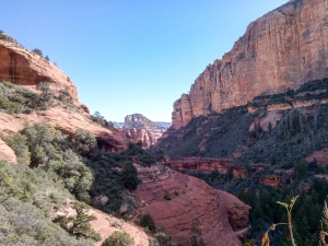
My trek began at 9:00am on 22 November 2014. The sun was just starting to creep up over the surrounding mountaintops adding some warmth to the early morning trailhead. My GPS temperature sensor was indicating a cool 50 degrees (10 Celsius) yet the weather and scenery was just about as perfect as it could be and complimented with a bright blue morning sky. It was cool, but the air was crisp and clean, and the distant red rock formations were beginning to light up from the rays of the sun.
The trail throughout Boynton Canyon is a mix of hard packed red clay, loose sand, and smooth rocky areas. During the entire trek, there were no difficult footing issues, so low ankle trail shoes should suffice. This trail would be perfect for trail runners, but mountain biker enthusiasts are prohibited. However, mountain bikers zip by occasionally utilizing the beginning of the main trail then fork off onto Deadman’s Pass Trail.
My first impression of the trek was impressive and very family friendly. Later on in the day, several family members were sitting along set-back open sides of the trail having lunch with their young children and elderly folks.
Trail Issues
My star ratings for Boynton Canyon Trail fell off to a mid level 3.8 score. This was my reasoning: The first 1.2 miles (1.9 km) along the hike, there were numerous luxurious homes adjacent to the west side of the trail along with the popular Enchantment Resort close by as well. The picturesque red rocks accented with tall ponderosa pines were blemished with home rooftops and cars in the driveways. Other issues regarding the early part of this trek was since the area was somewhat congested; sounds of cars and trucks overpowered the quietness of the forest. So, almost one third of the hike I felt was marred by local development. Also, trekking through the trail especially deeper within the canyon, there were not many open scenic views.
My final star removal from the Boynton Canyon Trail was due to the trail’s popularity, I must have crossed paths with 50 or more people along the way. In addition, with this kind of congestion, the feeling of the canyon was never in a quiet and tranquil state. Conversing with a Park Ranger nearing the summit, she confessed Loy Canyon and Long Canyon were her favorite trails due to the solitude and pastoral experience with nature.
Positives
Boynton Canyon Trail is a box canyon. There is only one, 3.81 miles (6.2 km) trail in, and only one trail out. Once you reach the final multi-colored rock wall canyon at the end, there is a wonderful plateau off to the right side, which continues on for another .25 miles (.4 km). This final plateau provides you with excellent panoramic views of the canyon cliffs.
Although, several people were present, it did not hinder the beauty this canyon conveys to the hiker. While at an elevation of 5,213 ft (1589 meters), looking down below at a dazzling array of maples and mighty oak trees, the splendor of the overall scenery was breathtaking.
The temperature along the trek fluctuated enormously, especially down in the cooler portion of the canyon below, then warmed up dramatically higher in elevation due to the exposure from the sun beating down upon the deep red rocks. I was able to dry my hiking shirt out on the plateau’s warm, radiating surface within a few minutes while having a bite to eat and taking in the great view. Several blogs have mentioned Boynton Canyon Trail is the prettiest trail in Sedona. During the September and early October, I am sure the foliage colors would be remarkable since the density of deciduous maple trees flourish deep within the canyon.
Hiker Friendly
Several hikers were seen scampering amongst the off-trail woods exploring in search of ancient cliff dwellings.
Everyone I spoke to along the canyon was amazingly friendly. However, one female hiker was becoming very frustrated that her significant other was hiking minutes ahead of her. I asked if they began hiking the trail together. She replied, “Yes!” but she also voiced her opinion that he was being, “incredibly rude” in not slowing down and waiting for her. I wasn’t expecting such drama along this nature hike, but venturing out in the wilderness, being prepared is the first concern. So my advice to couples hiking is to stay close and enjoy the experience together.
View all images of the trail: http://www.davidpinter.com/arizonatrekker/treks/boyntoncanyontrail/
View Complete Trekking Data: http://www.movescount.com/moves/move46002161
View GPS Map and photo locations: http://www.davidpinter.com/arizonatrekker/treks/boyntoncanyontrailgps/
Directions:
From Sedona on Route 89A, go west on Dry Creek Road. Follow to Boynton Canyon Trail Road then take right at “T”. Trailhead is 200 meters on the right.


