
Highline Trail Overlook, Horton Creek – Highline – Derrick Trail Loop, Payson, Arizona
Rating: 4.3 out of 5 stars
Recommended supplies and information:
- Bring at least 100 ounces (3 liters) of water
- Small First Aid Kit
- Trekking Pole for Steep Inclines
- Tent or Shelter to Stay the Night
Approximate Trekking information:
Distance Round Trip: 9.3 miles (14.9 km)
Total Hiking Time: 4-5 hours
Elevation at base 5,482 ft to 6,939 ft: 1,447 ft Ascension Climb
Elevation at base Metrics: 1,670 meters to 2,115 meters: 445 meters Ascension Climb
Temperature for April 25, 2015: 59.2 F to 72.6 F / 15.1 C to 22.5 C

Horton Trailhead Parking Area, Horton Creek – Highline – Derrick Trail Loop, Payson, Arizona

Horton Trailhead Starting Point, Horton Creek – Highline – Derrick Trail Loop, Payson, Arizona
Delightful Trail with Plenty of Surprises
The Horton Creek – Highline – Derrick Trail Loop is by no means an easy trail to hike. This 3 trail connector loop ascends and descends gradually at the beginning and latter portions of the hike, but along the Highline portion of the trail several locations steeply incline and decline in elevation. Many areas of the Horton Creek – Highline – Derrick Trail Loop are obscured by the tree line, but there were a few strategic spots along the way that lead itself to majestic green mountain scenery.
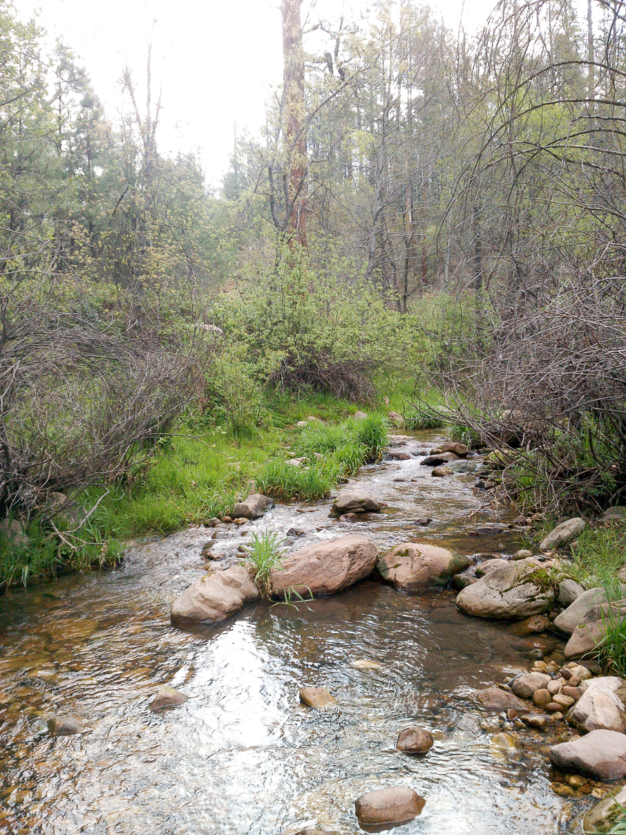
Rocky Stream Near Horton Picnic Area, Horton Creek – Highline – Derrick Trail Loop, Payson, Arizona
The Trail: Confusing to Find the Trailhead Starting Point
After finding the Horton Creek Parking Lot the area becomes a little confusing. I wasn’t the only hiker perplexed in locating the trailhead.

Horton Creek Trailhead, Horton Springs – Derrick Trail Loop, Payson, Arizona
The above image points out that the trailhead is on the opposite side of the parking lot and a little ways up on a dirt road completely hidden from view. In the parking lot near the restroom facilities displays the Horton Creek Trail information. Behind the restroom is a short trail that initially lead me down to a daytime picnic area only. The short trail winds to a small section of Horton Creek. I had to turn around and search for the main trailhead.

Connecting Trails, Horton Creek – Highline – Derrick Trail Loop, Payson, Arizona
I am going to breakdown the Horton Creek – Highline – Derrick Trail Loop into the three color coded sections as illustrated by the image above. Yellow is a moderate climb, Red is a more difficult section, and Blue is easy hiking.
Horton Creek Trail – Yellow Section
The Horton Creek Trail starts off a little rubbly then smoothes out nicely into a packed dirt trail a few hundred meters into the hike. The surrounding areas of the trail are very clean and the trail itself is wide with an attractive mix of meadows and dense foliage throughout the trail.

Wide Trails, Horton Creek – Highline – Derrick Trail Loop, Payson, Arizona

Meadow Areas of the Trail, Horton Creek – Highline – Derrick Trail Loop, Payson, Arizona
The entire Horton Creek Trail gradually ascends from the trailhead all the way to the Highline Trail junction without ever descending. At about .5 miles (.8 km) into the trek, off to the right side of the trail, I could see several tents set up with overnight campers. Along this trail also to the right, Horton Creek meanders all the way up to the juncture as well. Most of the time the creek is hidden by the forest, but there were several opportunities to veer down some short terrain to view the creek. There are plenty of camping sites and several areas to erect overnight shelters. I would highly recommend camping along this trail.

One of Many Camping Sites, Horton Creek – Highline – Derrick Trail Loop, Payson, Arizona

Early Morning Sun, Horton Creek – Highline – Derrick Trail Loop, Payson, Arizona
One of the many surprises Horton Creek Trail has to offer is a few off-trail mini waterfalls. Although the waterfall is only about 3 feet high, the atmospheric feel of gushing water and thick forested terrain made for a pleasant environment.

Short Waterfall, Horton Creek – Highline – Derrick Trail Loop, Payson, Arizona

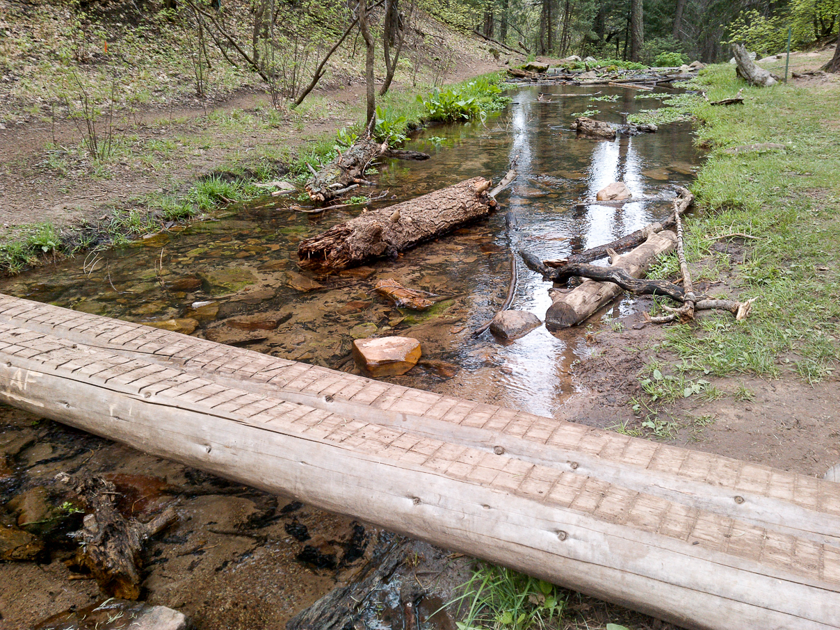
Creek, Horton Creek – Highline – Derrick Trail Loop, Payson, Arizona
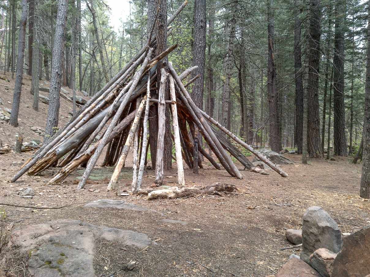
Teepee by the Creek, Horton Creek – Highline – Derrick Trail Loop, Payson, Arizona
While hiking along the trail (around 2 miles (3.2 km) in), looking far to the right , I came across another fascinating point of interest. A large teepee had been constructed at another obscured portion down by the opposite side of the creek.

Short Waterfall by the Teepee Campground, Horton Creek – Highline – Derrick Trail Loop, Payson, Arizona

Quiet Creek Portion by the Teepee Campground, Horton Creek – Highline – Derrick Trail Loop, Payson, Arizona
This camping ground also included a short waterfall. On account of all the tall pine trees scattered around, the campsite is nicely shaded from much of the sun. This would lend to a perfect place to camp especially during the hot summer months of July and August.

Boy Scout Travis by His Tent, Horton Creek – Highline – Derrick Trail Loop, Payson, Arizona
At about 3.14 miles (5.0 km) into the trek I stopped off at one of the campsites. I met a group of Boy Scouts that were camping out for the weekend with their guides. The photo above is Travis, one of the Boy Scouts standing by his tent. There were a total of about three troop members at this campsite, but I met up with eight others further along the trail near Horton Springs. I was informed that 25 more group members were on their way later in the afternoon.

End of Horton Creek Trail Junction, Horton Creek – Highline – Derrick Trail Loop, Payson, Arizona

Trail becomes Steeper Along Highline Trail, Horton Creek – Highline – Derrick Trail Loop, Payson, Arizona

Mountain View, Horton Creek – Highline – Derrick Trail Loop, Payson, Arizona
The final mile of the trail became steeper and I finally reached the endpoint of Horton Creek Trail. I came to the junction of Highline Trail and headed off west about .8 miles (1.2 km) to reach a high point to get some photographs of a cleared view of the adjacent mountains.

Blocked Mountain View, Horton Creek – Highline – Derrick Trail Loop, Payson, Arizona
Although the mountain views from the traversing Highline Trail were mostly blocked by the tall trees, a great sense of peace and solitude was highly appreciated. Heading back down to the Horton Creek Trail junction, I continued a little further to view and takes some photographs of the Horton Springs location.
Horton Springs, Horton Creek – Highline – Derrick Trail Loop, Payson, Arizona
The 4 mile (6.4 km) hike to the end of Horton Creek Trail is 100% family friendly and is recommended for younger children. Since the trails are wide, gradually ascend, and provide many interesting spots along the way, it’s a great place for a family adventure.

Ridge Line Along Highline Trail, Horton Creek – Highline – Derrick Trail Loop, Payson, Arizona
Highline Trail – Red Section
This portion of the entire trail runs 2.5 miles (4.0 km). Heading east onto the Highline Trail ascends gradually; eventually reaching a flattened ridge line with more obscured scenic views. The trail then drops a few hundred feet taking you though a heavily shaded and dense forest. Continuing on the Highline Trail, the winding and switch-backing path then ascends sharply for about 1 mile (1.6 km) gaining a 500 foot (152 meter) elevation increase. This was by far the toughest part of the entire trail. On several occasions, I was forced to stop to take a breather then continued on.
Poor Footing on the High Ascension Portions of Highline Trail, Horton Creek – Highline – Derrick Trail Loop, Payson, Arizona

Highest Point of the Entire Trek, Horton Creek – Highline – Derrick Trail Loop, Payson, Arizona
The trouble wasn’t so much the intense incline, but rather than the poor footing and loose rocks trekking up the trail. This is where a good trekking pole will come in handy for sure. Once reaching the leveling off point I noticed an altitude of 6,939 feet (2.115 meters) on my Suunto watch. This is the highest point of the entire looping trek.
Ultra Marathon Trail Runners
While struggling up the rigorous mountain trail of Highline, out of nowhere, two ultra marathon trail runners zipped past me like I was standing still (I actually was standing still gasping for breath). The shirtless male, in phenomenal condition, was leading the way, followed by his female companion carrying a hydration pack. They headed up the trail so quickly and with such speed, it reminded me of two gazelles running effortlessly through the forest. Apparently, by conversing with two log-in point judges further up the trail, a 51 mile (82 km) marathon was underway along the Highline Trail and Mogollon Rim.

Highline Trail Obscured View, Horton Creek – Highline – Derrick Trail Loop, Payson, Arizona

Old Tree, Horton Creek – Highline – Derrick Trail Loop, Payson, Arizona

Promontory Trailhead, Horton Creek – Highline – Derrick Trail Loop, Payson, Arizona
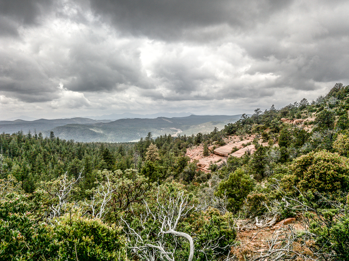
Reaching the last stretch of the Highline Trail, beautiful, scenic, and panoramic views began to come into view.

Scenic View Along Highline Trail, Horton Creek – Highline – Derrick Trail Loop, Payson, Arizona

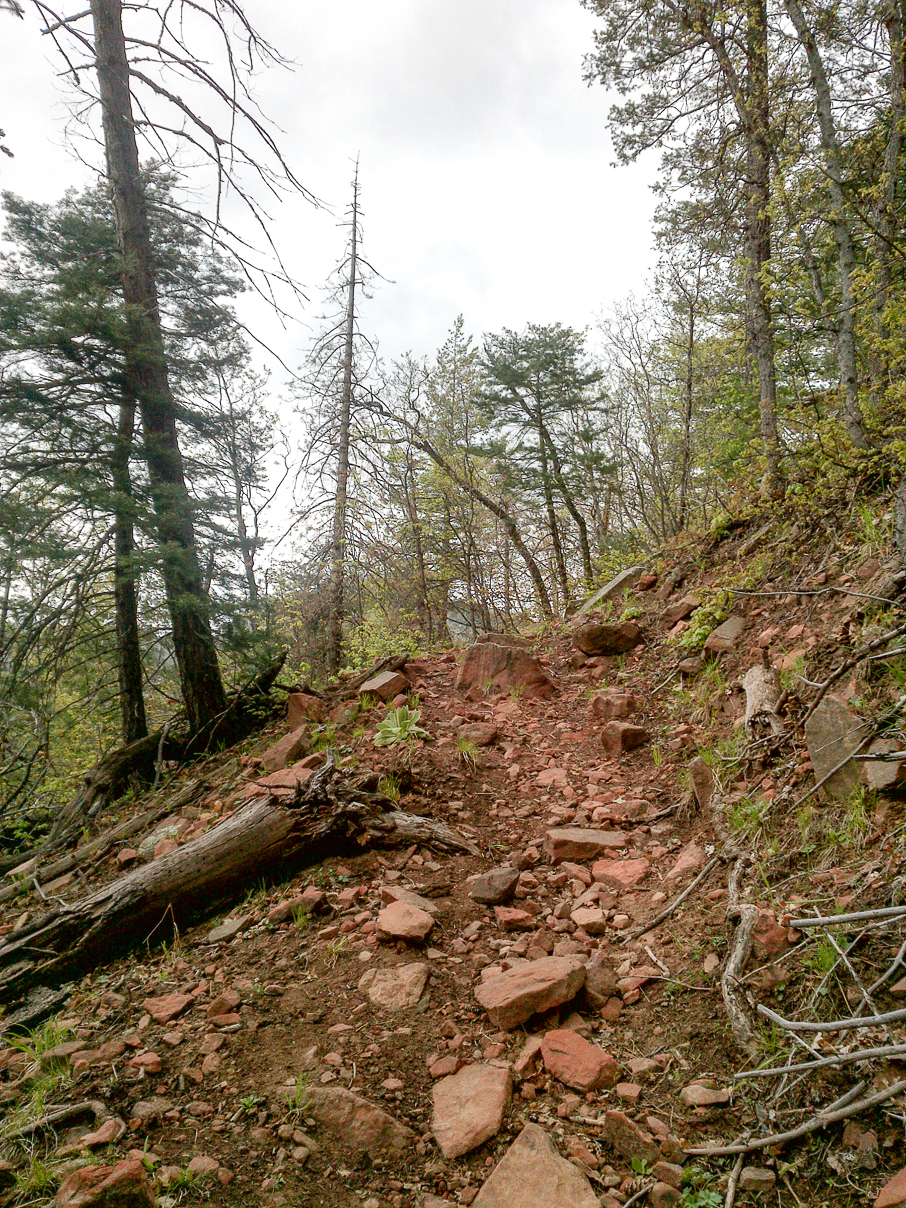
Red Rocky Trail with a Green Peaking Mountain, Horton Creek – Highline – Derrick Trail Loop, Payson, Arizona
The trail slowly began to turn a reddish clay color complementing the stunning green mountainside all around. Highline Trail started out to be quite cumbersome, but eventually proved to be well worth the effort in the end. Highline Trail is a good challenging trail, but not recommended for younger children.

Derrick Trail – Blue Section
Derrick Trail is the last portion of the entire loop and descends gradually to the end. While there were no very spectacular views along this trail, there was, however, nicely covered foliage and meadows throughout. Low lying distant mountain views could be seen sporadically.

Blooming Foliage, Horton Creek – Highline – Derrick Trail Loop, Payson, Arizona

High Desert Plant Life, Horton Creek – Highline – Derrick Trail Loop, Payson, Arizona
Many bushes were covered with blooming pink petals and were accented nicely with thick green leaves. Other high desert cactus and pine trees allowed for picturesque moments.

Pine Trees and Distant Mountain View, Horton Creek – Highline – Derrick Trail Loop, Payson, Arizona

Rubbly Derrick Trail Nearing the South End Portion, Horton Creek – Highline – Derrick Trail Loop, Payson, Arizona
Strong scents of fresh pine tree and blankets of pine needles and pine cones added nicely to the very pleasing environment. Derrick Trail began to open up at around the midpoint mark and distant mountains began to come into view. The trail at this section, however begins to turn a little more rubbly the further down the trail you trek.

Water Tank at End of Trek, Horton Creek – Highline – Derrick Trail Loop, Payson, Arizona
To complete the entire Horton Creek – Highline – Derrick Trail Loop, keep an eye out for a very hidden off-shoot trail path that brings you back to the Horton Creek Trailhead spot. I almost missed the turn off, but luckily, I happened to notice, through the trees, a parked camper and some vehicles at the overnight camping facility. Then into view I spotted the water tank. Even if you miss the off-shoot trail, Derrick Trail takes you to the bottom of the road near Route 260. You’ll just have to walk about a couple hundred meters up Zane Gray Road back to the Horton Creek parking lot.
The People
I noticed a sense of energy with everyone I came across on this journey. The weather was perfect, the camping grounds were clean and everyone seemed to be thoroughly enjoying themselves. A few of the hikers I spoke with were very knowledgeable about the surrounding areas and I felt very welcomed on these trails. I did come across some younger children, but they were near the base overnight camping facilities with their families.
Final Thoughts: In Summer Months, Expect Crowds
My experience was very positive throughout this looping trail and there was certainly plenty of variety of interesting things to see along the way. The area is very clean, the people were pleasant, and a good sense of fun energy was in the air. On the downside, there were not as many breathtaking views and eye popping moments to memorably cherish as I normally like, but the Horton Creek – Highline – Derrick Trail Loop is an excellent challenge with plenty of good nature abound and I would highly recommend these trails for runners.
View all images of the trail:
http://www.davidpinter.com/arizonatrekker/treks/hortonhighlinederricktrailloop/
View Complete Trekking Analysis One Way
http://www.movescount.com/moves/move60292305
View GPS Map and photo locations:
http://www.davidpinter.com/arizonatrekker/treks/hortonhighlinederricktrailloopgps/

Directions:
From Payson, head east on Route 260 for about 16 miles. Take a left on Zane Gray Highway. Horton Creek Parking lot will be .8 miles (1.2 km) on the left. Parking lot fills up quick so arrive early.

Great website, nice photos.
I’m new to the area and excited to start hiking and seeing the beauty of nature that Arizona has to offer.
It was a pleasure meeting you thank you for the information
LikeLike
Well it was a pleasure to meet you today Rosemary and thank you for taking a look at the photos.
Arizona has so much to offer all levels of trekking and biking.
Enjoy your stay and Trek Safe and Smart!
~ David Pinter, Arizonatrekker.com
LikeLike